3D thermography Increasing the efficiency of urban construction planning
As part of an advanced research project, thermography technology is being used in Dortmund to capture thermal images from the air. These are used to identify refurbishment requirements and thus support climate adaptation strategies in urban areas.
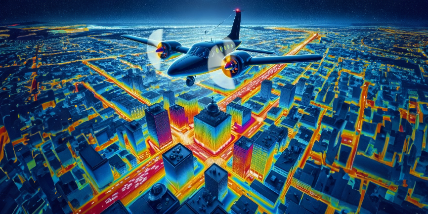
Night-time thermographic flights are used to analyse the entire urban area from the air in order to create a 3D thermal imaging model of the urban infrastructure. This model is intended to provide valuable insights into the energy efficiency of the buildings and provide property owners with exclusive data about their buildings. The aim is to precisely determine the need for refurbishment by recognising insulation weaknesses.
The flights are part of the CATCH4D research project, which focusses on climate adaptation through thermography and heat mapping. This research initiative, led by the Institute for Regional and Urban Development Research in cooperation with the City of Dortmund, uses aerial thermography to assess the condition of urban building insulation and identify acute renovation needs.
The images not only provide a basis for effective climate protection measures, but also open up the possibility of extensive applications. The spectrum of possible uses ranges from monitoring forest fires to estimating the yield of solar installations. Data protection is a top priority: Personal data cannot be captured due to the image resolution.
The project, financially supported by Google.org, demonstrates the importance of interdisciplinary collaboration for urban development and climate protection. The combined 3D thermographic aerial images, which were developed in collaboration with Anhalt University of Applied Sciences, enable a new dimension of data collection and analysis for the property sector and urban planning.